GeoRiver Release 4.0

There are big advances in our GeoRiver software which have improved our river channel processing efficiency significantly. [nbsp]We have fully tested the latest version and the release should be commercially available in March. [nbsp]The whole user experience has been cleaned and refined making it more pleasurable to use. [nbsp]There is less effort needed from the user as button presses have been minimised and automation increased. [nbsp]The software dashboard has been modified based on user feedback and is more organised and informative. [nbsp]Curved geometry is now supported from DXF sources so accurate representations of structures can be traced for model output files. [nbsp]The software is in great shape for raw survey data processing, archive data integration and exporting river survey deliverables. River channel data manipulation just got a whole lot easier, the site survey side is still a tough job but then we can’t have it easy all the time!
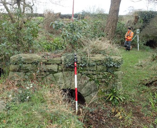
In February a team of surveyors headed to South Wales to start a project for Natural Resources Wales.[nbsp] The work included roughly 45 open channel cross sections and 30 in-channel structures such as weirs, culverts, bridges and pipes.[nbsp] They started by arranging land access and seeking out possible GNSS base locations.[nbsp] Once secure, the control station was observed and processed to stations from the Ordnance Survey Active Rinex Network, giving it an E2 classification in accordance with the EA surveying specification.[nbsp] The survey team then used ‘real-time kinematic’ (RTK) GNSS to measure the sections where required utilising a Leica TS15 Total Station.[nbsp] Whilst travelling between sites the surveyors captured RTK checks on existing NRW control – a quality control measure carried out on all of our surveys.[nbsp]
All sections were processed and annotated through Storm GeoRIver software package. [nbsp]River cross sections were then processed to provide a long section representation of the channel. [nbsp]The long section helps show all significant changes in elevation throughout the channel and all in channel structures. The long section and location plan are then presented one above the other in a cad drawing to aid with interpretation of the data. Model data was supplied in Flood Modeller Pro and HecRas files.
Other News

Which RPAS will win Storm’s Investment?

Collaborative Survey Techniques offer Next Level Solutions


