Do All Rivers Lead to Liverpool?
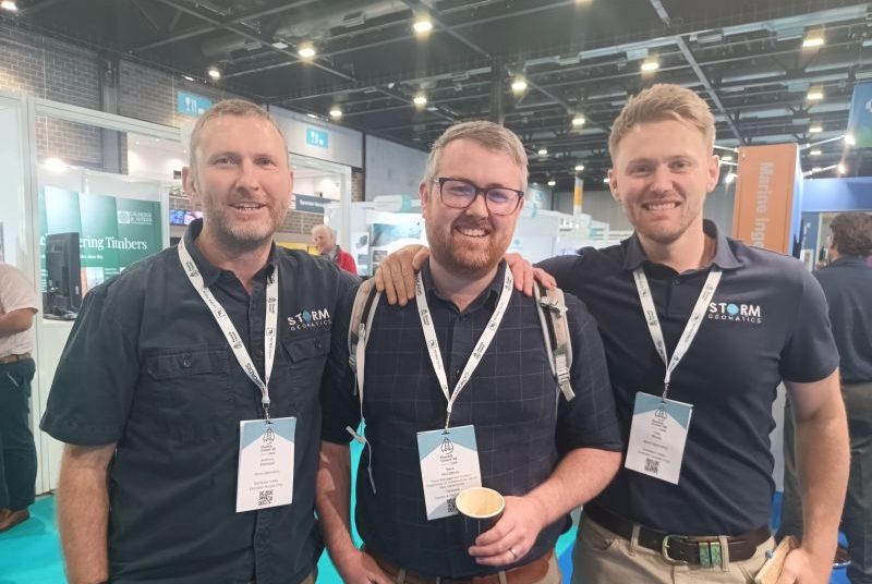
Hosted in the city of Liverpool for the first time, Storm Geomatics attended CWIEM’s Flood and Coast Conference and Exhibition. The senior team from Storm spent their time meeting new contacts and also catching up with existing clients and ex-Storm colleagues.
A very lively few days provided the opportunity for discussions around some of the programmes and priorities shaping the future of the flood risk and water sectors. Conversations regularly focused on AMP8 investment, the Environment Agency’s CDF2 framework and the increasing need for organisations to make confident decisions based on reliable geospatial data.
Storm’s River Digital Twin® (RDT®) was a hot topic throughout the event. Rather than being viewed solely as a project output, geospatial data is increasingly being used to support long-term asset management, resilience planning and investment strategies.
The interest generated during the exhibition led to several CPD sessions being arranged, enabling clients to further explore the four modular stages of River Digital Twin® development and the benefits they can bring to both flood and environmental projects.
Storm would like to thank Jackson Civil Engineering for the invitation to participate as part of their supply chain exhibition team.
Project Spotlight: Snaith Ings Washland Reservoir
Understanding the condition and performance of critical flood infrastructure starts with accurate measurement, a great example of this took place in Yorkshire in June at a Measure in the Interest of Safety Site, a washland reservoir.
A recent survey at Snaith Ings Washland Reservoir in Yorkshire has helped provide detailed geospatial data to support a greater understanding of this important flood storage asset. As investment in flood resilience continues, access to reliable baseline data remains essential for asset owners and project teams responsible for planning future improvements and maintenance activities.
Read the full case study HERE
Case Study Credit: Tom Isaac
River Dee Survey Progress as Conditions Improve
Survey teams recently returned to the River Dee in North Wales following the subsidence of winter flood conditions. Lower water levels allowed the deployment of a survey boat, providing improved access to sections of the river that had previously remained inaccessible.
The ongoing project involves the collection of cross-sectional survey data across a large and remote reach of river with a well-documented history of significant flooding. Extensive meanders, limited access points and challenging logistics have required careful planning to ensure safe and efficient data collection throughout the programme.
One of the team, Jake Beddard commented:
“We headed back up to North Wales to tackle the River Dee once again. Winter flood levels had finally subsided, and we were able to launch a boat this time and see where the banks of the channels were instead of them being underwater. This project involves collecting cross-section data on a large, remote stretch of river known for its dramatic flood history. We faced challenging logistics trying to navigate the vast meanders that would take our teams away from any roads and critically launch/exit points for the boat. It was interesting trying out different strategies to get us to our survey sites. Our work is ongoing on the Dee and we look forward to returning to the open countryside of North Wales.”
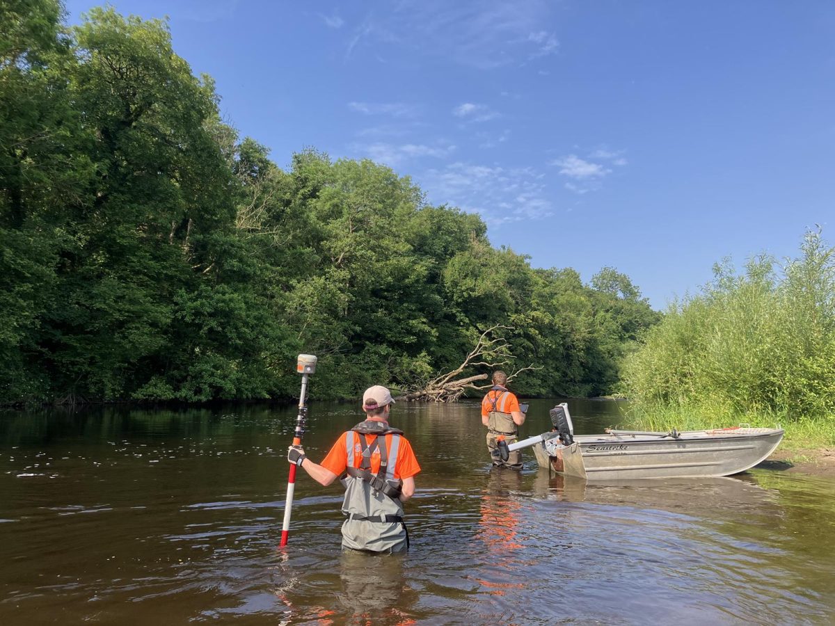
Projects of this nature highlight the importance of specialist river survey expertise in providing the data required to support flood modelling, risk assessment and future resilience planning. Storm surveyors work in rivers every day and are trained to pick up features other surveyors would easily miss.
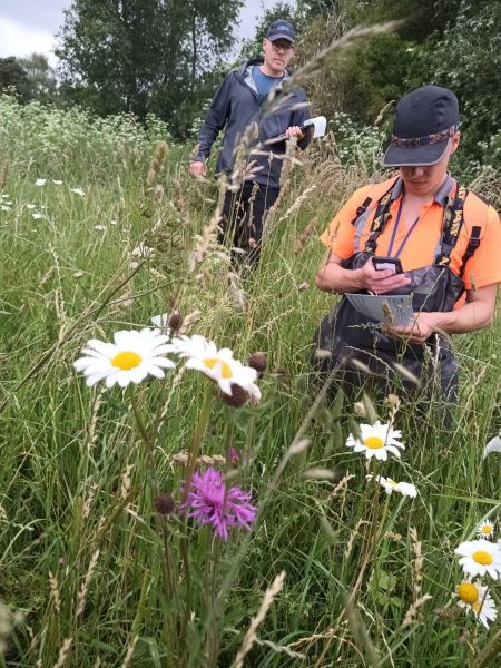
Understanding Seasonal Change
Two of Storm’s surveyors spent a day helping out sister company Storm Wildlife undertake the annual species count at Halford Flood Meadow. This exercise contributes to the long-term understanding of habitat change and biodiversity as the meadow continues to transform from a grass only area to a species rich flood plain.
Seasonal Change in Survey: Keeping the Quality
The second wave of extreme heat hitting the UK in late June served as a reminder that seasonal change can significantly influence the quality and value of survey data. Different survey techniques deliver the best results at different times of year, making forward planning increasingly important for project success and reduce risk of project delay. To help organisations plan more effectively throughout the year, Storm’s Yearly Survey Planner is available to download.
Local Bragging Rights Perserved!
June also saw the return of Storm’s annual cricket fixture against local team, Ilmington.
Played in good spirits and under considerably drier conditions than many of Storm’s survey projects, the match provided an opportunity for the team to step away from rivers and enjoy some friendly competition.
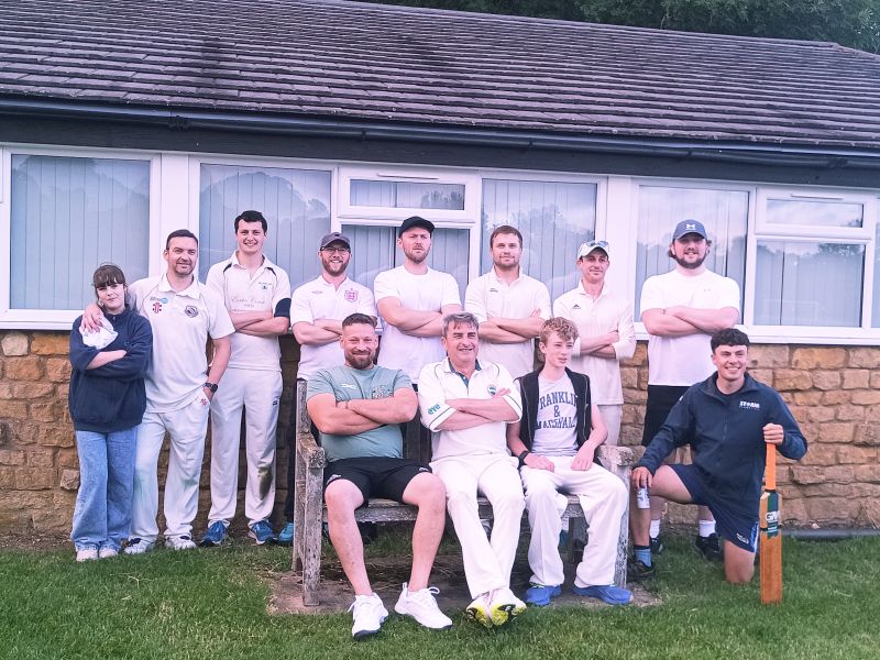
This year’s encounter resulted in a victory for Storm, ensuring local bragging rights remain firmly in Storm’s possession until next season.
Congratulations to everyone involved, and thanks to Ilmington CC for another enjoyable fixture and a great sociable time after the game watching England win their opening match in the FIFA World Cup.