Collaborative Challenges: Surveying Success
The Background
- Date
- May 2024
- Client
- Pell Frischmann
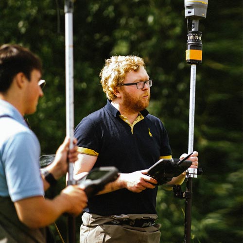
A Storm Geomatics survey team led by Senior Surveyor Laurence Washbrook undertook the task to provide essential data to create a site master plan for a highway network modification, flood risk assessment, drainage design, and landscape and ecology surveys.
The Challenge
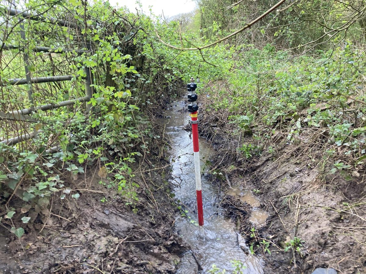
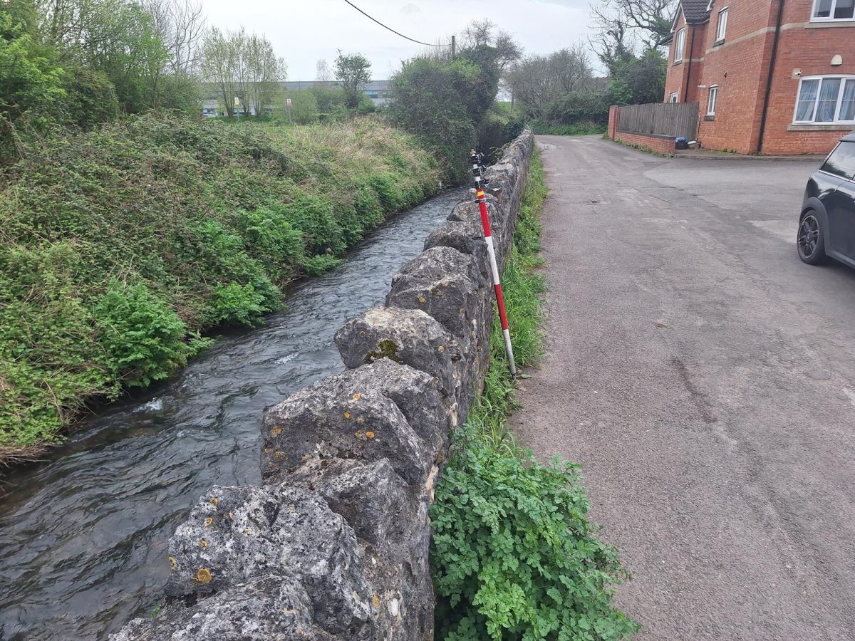
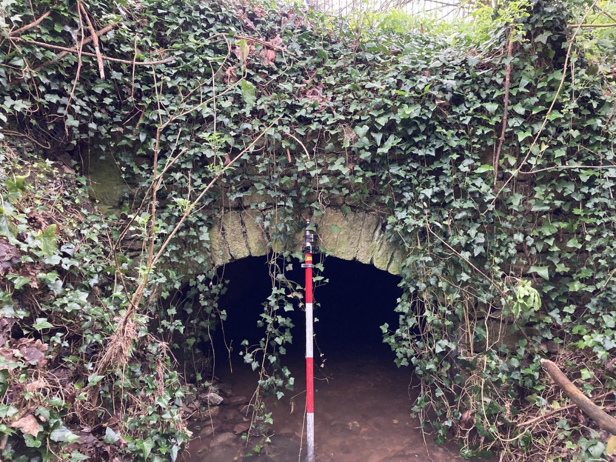
An existing river channel survey had provided incomplete data owing to poor land access arrangements being carried out by a previous survey company. Storm Geomatics overcome land access barriers by using a two stage approach, firstly a desktop search and then a letter drop, this ensures that all landowners are aware that a survey is about to take place. Parts of the river channel within private gardens posed significant access challenges, however using Storm’s pre-site planning techniques Laurence gained access to all required gardens with full landowner permission.
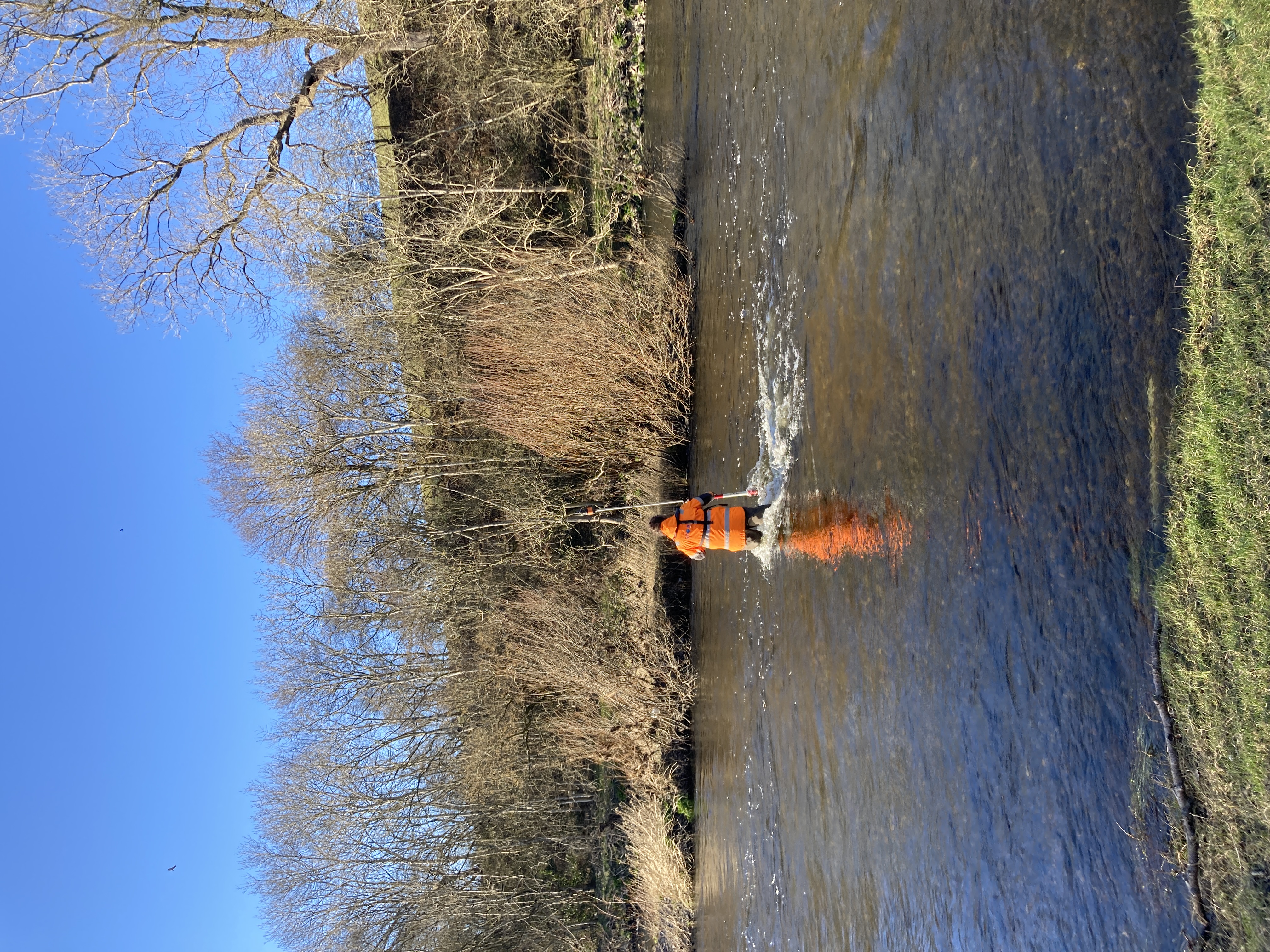
Additionally, high walls and restricted entry made data collection difficult, however, the team’s water safety training proved valuable at this stage as they were able to move along the watercourse to get from one survey location to the next.
A standard topographic survey was required to inform flood plain design and management. In addition, a drainage survey was also carried out to integrate with the flood model.
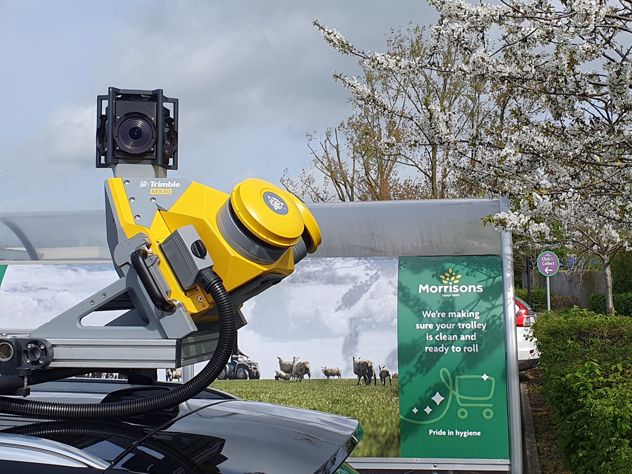
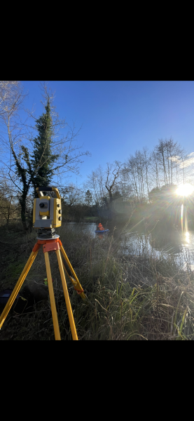
Safety concerns on the busy A371 road complicated traditional survey methods. Avoiding traffic management was crucial, necessitating innovative solutions for accurate data collection. The team resourced the capabilities of the Trimble MX50 mobile mapping system to produce a full point cloud of the survey extent working collaboratively with Korec.
The Results
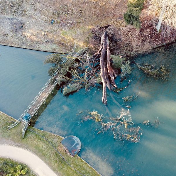
River channel data was captured and presented to the client to accurately represent the river geometry and therefore the river model was easier for the engineers to build and run, saving time and money for the end client. The resulting flood risk assessment was accurate and passed planning standards in terms of quality of geospatial data.
A full topographic survey of the area was delivered on time to the client, despite the busy A371 road through the site. By recognising the limitations of the data capture during the traditional manual survey, surveyors processed the data collected by the Trimble MX50 extracting topographic features to merge with the data collected by the manual topographic survey. Thus, delivering superior data to their client whilst avoiding traffic management costs and potentially exposing surveyors to the danger of a busy road.
This project underpins the significance of expertise and innovation in overcoming challenges in land surveying. The proactive approach, coupled with innovative use of advanced technologies, not only addressed the project’s challenges but exceeded expectations.

- Laurence Washbrook
Senior SurveyorRecent News
From Dee to Data: Storm Delivers Dynamic River Data
What’s Driving Our Success in Surveys & Leadership?